Multi Asset Network Tracking Information System
Web-based GIS data collection and workflow

Web Based
Hosted and always available. All you need is Internet access.
Lightning fast
Built on top of Google's map rendering API.
Mobile ready
Optimized for viewing on mobile devices with a touchscreen friendly interface.
Easily record geographical data, incidents and work
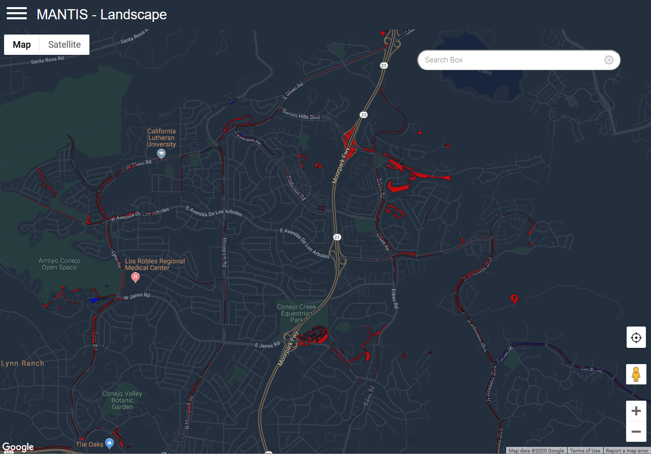
Geographical assets can be set on a recurring maintenance schedule or dynamically created with full history tracking. Assets can be imported from your existing GIS system.

Realtime
See work performed against assets in realtime.
Contractor Accessibility
Allow restricted access by 3rd parties.
Alerts by Email/Text
Send email/text message alerts based on status.
Emergency Response Workflow
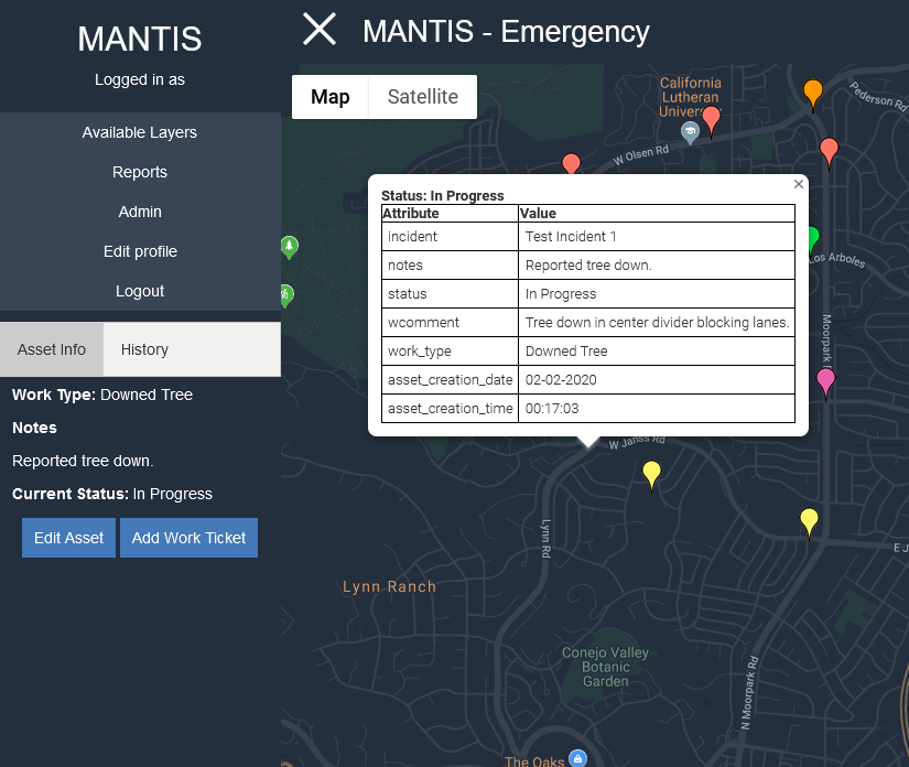
Drop pins and notify select individuals to make emergency response more fluid.
GIS Integration
Integrate data from MANTIS into your existing GIS solution. Data provided in real-time via RFC 7946 GeoJSON standard and/or OGC KML.
Use Potential
Contractor Tracking
Track contracted work status and completion on geographical assets. Can be setup to track both recurring work and real-time work requirements.
Emergency Response
Track geographical incidents during an emergency. Drop pins on new incidents and have notifications sent to responding incident personnel.
Everyday Workflow
Augment your existing day-to-day operations by enabling staff to drop pins at incident locations and notifying required personnel. Easily keep staff updated on current workloads.
GIS Data Collection
Use any web-connected device to collect GIS data for later analysis. Collected data can be integrated with 3rd party GIS software in real-time.
Clients

City of Thousand Oaks The City of Thousand Oaks has utilized Mantis since 2012 to help facilitate communication between Public Works staff and its contractors. MANTIS is used in the field for standby and management staff to keep track of … Read More
Contact Us
Schedule a Demo
For more information and to schedule a demo, please fill out the contact form.